
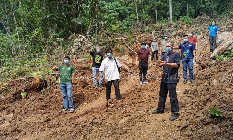
Residents of The Dales (Panorama Tambun Perdana) are in unrest as constant land clearing activities next to their homes located at the foothills of Gunung Panjang, which is also a cemetery land reserve, may unpleasantly invite higher risks of landslides, rock-falls and flash floods due to the housing area being in close proximity to the limestone hills.
According to Wong Pek Yin, a resident representative of The Dales, the reserve is around 8-acres wide and ownership belongs to the Perak State Islamic Affairs and Malay Customs Council (MAIPk). This was verified by the council themselves.
“This isn’t the first time contractors attempted to clear lands near our homes,” she noted in a statement dated June 11.
“In 2011, a contractor started clearing works, claiming that herbs were to be planted but he was actually there to mine iron ore tailings,” Wong remembered. “In 2017, another contractor claimed that the land was to be cleared for a durian plantation project. Instead, he brought a backhoe and dug up rocks in an old iron ore mine, which had totally nothing to do with planting durians.
“Now, the same contractor from 2017 made a return to build boundary fences, which we (The Dales representatives) were informed by MAIPk. The construction works started with an excavator on June 4,” she added. “No approval from relevant authorities was obtained for this. Not only that; the fact that the contractor chose an area which was anywhere but near the reserve boundary made his intentions seem suspicious.
“Even though those works had stopped since June 10, they will most probably make another return, but with proper work approval,” Wong lamented.
The residents’ concerns were validated in a letter dated May 20, 2011, by the state Geoscience and Mineral Department (JMG), which stated that Gunung Panjang is full of colluvium deposits (accumulation of materials at the base of hill slopes) made of loose limestone and earth, thus being sensitive to physical disturbance. It also acts as a natural buffer zone should there be any incidents of land or rock slides.
“The contractors’ audacity to lie about their real purposes to clear the lands and disregard the fact that the area is a limestone foothill has shown greed as the driving force to exploit the reserve,” Wong bemoaned.
“How could they not think of the possible consequences? Are there really any commercial or economical reasons for their repeated exploitation of the property?” she expressed.
“We are fighting this issue because we bought our properties here with hard-earned money. I’m sure no one would want to live near an unstable land reserve, let alone a mine, farm or any places that could damage their properties, should there be any developments involved.”
The residents petitioned to appeal for relocation of the cemetery reserve and declaration of Gunung Panjang as a permanent buffer zone. 102 signatures from the residents were obtained and their objections have been submitted to several relevant authorities such as MAIPk, JMG, Perak Land and Mines Office (PTG), Perak Public Works Department (JKR) and Enforcement Division of Ipoh City Council (MBI).
Meor Razak Meor Abdul Rahman, field officer of Sahabat Alam Malaysia (SAM), an environmental rights NGO, has a similar sentiment, saying, “The limestone hill should be gazetted as a protected area to not only ensure preservation in the long run, but also to prevent more exploiters from doing something harmful to the lands.”
In a similar update, Perak Menteri Besar, Dato’ Seri Ahmad Faizal Azumu said that he was informed of this matter and necessary actions would be taken as soon as possible.